Spanish explorers climbing to the top of Mt. Diablo in the early summer of 1772 thought they had stumbled onto a great inland lake.
They reported seeing nothing but water as they scanned the horizon from north to south. In the distance, they spied the foothills of the Sierra that weres yet to be explored by Europeans.
The Spanish band turned around and headed back to Yerba Buena (modern-day San Francisco) where they unwittingly wrote the first documented account of the Central Valley’s long tenacious history of flooding.
The only things that prevent a repeat of the 1772 landscape today is a series of dams dotting the Sierra and levees restraining the Sacramento and San Joaquin rivers as well as dozens of major and minor tributaries that feed water into them.
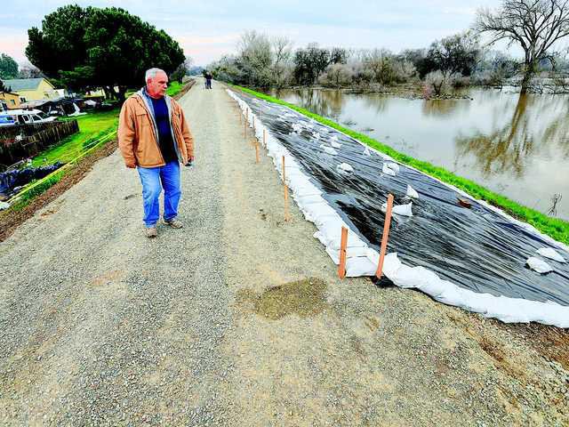
The first settlers in what is now modern-day San Joaquin County got a taste of the destructive forces of the rivers within months of arriving. They also had the misfortune of settling in the county’s most flood prone area — the 5,000-acre River Junction District located at the confluence of the Stanislaus and San Joaquin rivers eight miles southwest of Manteca where the January 1997 floods started when the first levee broke.
River Junction has flooded 11 times in the 95 years since almost a dozen miles of levees were built around the farm area with the formation of a reclamation district. Prior to 1927, the area flooded virtually at will every winter and even late spring when the Central Valley wasn’t in a drought cycle.
Mormon settlers
first flood victims
William Stout led a band of 20 Mormon men up the San Joaquin River from Yerba Buena. They sailed their launch known as “Comet” to a point that is now known as Mossdale. They continued up the river and established their colony on the north banks of the Stanislaus River about 1.5 miles east of where it flows into the San Joaquin River.
Within four months, Mother Nature turned on the spigot. The river rose eight feet in one hour in late December. By January, it overflowed its banks and flooded the countryside for miles. Stout wrote in his journal that the river was three miles wide looking toward Corral Hollow.
The frustrated Mormon company abandoned their settlement just in time to miss the soggy mess that greeted gold prospectors heading to the Sierra mining camps through Stockton in 1849.
Miners literally traveled through mud and water for miles to reach the eastern edge of the Central Valley.
It was common in early day Stockton for blocks of the city to have several feet of water for weeks in the winter.
Possibly the greatest flood of the 1800s occurred in January of 1862. That’s when conditions similar to those that led to the 1997 floods developed. Snowpack in the Sierra was 15 feet higher than the previous record in 1849-50. Rainfall in Sonora topped 102 inches, more than 60 inches above normal. All major tributaries to the San Joaquin River reached record-breaking stages.
Other major flooding during the 19th century in South San Joaquin occurred in 1867, 1868, 1880, 1881, 1884, 1890 and 1893.
The first major flood in the 20th century started in River Junction in February of 1938. Boats were used to aid marooned families while cattle were driven to higher ground near Manteca. Most roads were closed. The only access to Stockton was via the French Camp Road.
The Paradise Cut levee along Stewart Tract also broke in 1938. The levee failure on March 17 closed Highway 50 (now Interstate 205/Interstate 5) and made travel to the Bay Area impossible except by boat.
20th century’s worst
flood was in 1950-51
The 20th century’s worst flooding occurred in the winter of 1950-51. An unusually severe storm between Nov. 13 and Dec. 8 caused extensive flooding from what is now the Airport Way bridge on the San Joaquin River north to Bowman Road in French Camp.
Prime farmland was under water for weeks causing erosion, large deposits of debris and sand as well as weed infestations. Dead livestock and poultry were found throughout the area as the water receded. Losses topped $750,000.
By January 1951, levees on both sides of the Stanislaus River as well as the San Joaquin at Mossdale had failed. Highway 50, the predecessor to Interstate 5-Interstate 205, was closed for several weeks. Flood waters came within four miles of what is today central Manteca.
The French Camp Slough backed up threatening the county hospital. Workers protected the hospital with a temporary levee. The county honor farm was threatened and some prisoners were ordered evacuated.
By the time the disaster had ended, damage along the river topped $3 million and 2,000 people were displaced between Mossdale and French Camp.
In Stockton, 125 city blocks were flooded and 3,500 people were evacuated. Flood water remained in San Joaquin County’s largest city for nearly eight days with the deepest water reaching eight feet.
The 1950s saw several other floods.
The next levee break wasn’t until June of 1969 at River Junction. While damage was at a minimum in that flood, it did put the Manteca Sportsmen Club under six feet of water.
Flood occurred in 1983 at River Junction and 1986 along the San Joaquin. The last flood in 1997 covered nearly 70 square miles between Manteca and Tracy, damaged 700 buildings and caused damages pushing $100 million.
To contact Dennis Wyatt, e-mail dwyatt@mantecabulletin.com


