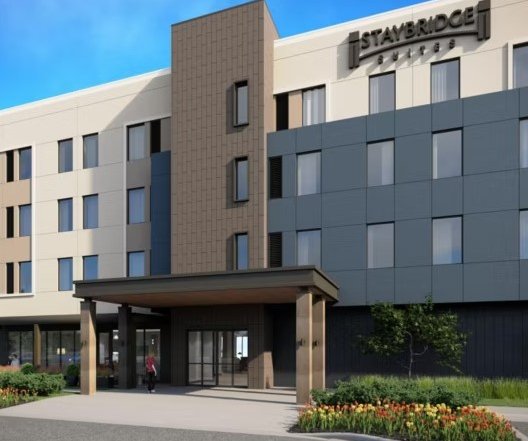
Manteca will be building a new police station.
But the location of the $56 million endeavor is no longer a sure thing.
The City Council on Tuesday is being asked to award LPA — the architectural firm responsible for designing the city’s transit center and animal shelter among other facilities — a $4.6 million contract for precise architectural and engineering plans.
At the same time, the council is expected to direct its Police Headquarters Ad Hoc Committee to “update the location” from 2346 West Yosemite Ave. to a location to be determined.
The council in mid-2024 adopted the location recommended at the time. It was on the northwest corner of where Wawona Street and Milo Candini Drive would intersect when they are extended just north of the Big League Dreams sports complex. It would back up to the wastewater treatment plant.
City Manager Toni Lundgren indicated the second look at the police station’s location “to thoroughly evaluate and select a site that best balances budget considerations, safety requirements, and community satisfaction prior to imitating the design phase.”
The council decision on the exact location for a new police station will likely stand for a half century plus.
The first permanent police station in the 100 block of Sycamore Avenue was used for 51 years before the current location was built.
By the time a new police is in place, the 1001 West Center Stret location will have served as the police department for almost 53 years.
There have been city residents that questioned the selected location north of BLD.
The reasons included:
*It would not be on a high profile street.
*It is almost sitting on the city’s border with Lathrop meaning it is an edge of the city that is permanently established. As such, it is not in a community friendly place which will only get worse as Manteca grows.
*The city is preparing to build a non-drop in homeless navigation center near downtown just off Main Street — the city’s marquee north-south arterial — while locating the police next to the wastewater treatment plant.
Mayor Gary Singh noted another consideration has come into play.
At one point, a developer was pursuing an apartment complex at the future intersection.
The project would have required extending the two streets.
But a shift in the apartment financing market has virtually dried up at least for the near horizon when the police station will be built. The developer has dropped plans to proceed for now.
That would mean 100 percent of the cost of the two street extensions plus accompanying infrastructure such as sewer water and storm drain lines wound be borne by the city.
Based on rough costs involved in two separate extension of Daniels Street over the past 20 years on vacant city property, the work needed could easily push $5 million.
Funding off-site in fracture for a police station would eat into Measure Q sales tax receipts the city convinced voters to pass to help meet a variety of pressing needs. And if the money was taken from growth fees, it would further reduce the city’s financial position to build other needed amenities such as a new city hall, a new library, and a new community center.
The city originally vetted six sites, sticking with city owned land that could accommodate an 8 acre police station campus.
Given the tight time frame, the final choice will need to be city owned land.
An adjoining site next to the wastewater treatment plant would also have a major infrastructure cost component.
Four others were along Daniels Street and are not more centrally located than the site originally picked.’
Worse yet from the perspective of the city’s overall economic strategy, all four sites will more than likely gain in value for commercial development as Manteca grows.
On the flip side, all four can access existing infrastructure.
The locations on Daniels Street by the new hotel east of Sizzler’s, between Milo Candini and Airport Way, and two locations west of Great Wolf Way that site near the corner of an unnamed cross street and McKinley Avenue.
682 South Main Street
could come into play
There is one other parcel large enough to accommodate police needs — 682 South Main Street.
The city is preparing to move forward with a homeless navigation center a portion of that 8-acre site that may cost upwards of $16 million.
The homeless navigation center would be near the heart of the city, three or so blocks south of downtown, and a block off the city’s main north-south arterial — Main Street — but with no direct access to it.
The city is moving closer to signing contracts with architects that will lock in the respective sites.
It has prompted some to wonder whether the city has the right projects but at the wrong sites.
The police station would be more central — and certainly more high profile — on South Main Street.
The police station, as now planned, would be on city property yet to be developed that is adjacent to — but not part of — the city owned family entertainment zone.
The city twice looked at locations for a police station where and near the site for the proposed navigation center is going including 682 South Main Street (where it is proposed to be built on the eastern end of the parcel) and 555 Industrial Park Drive (where the temporary emergency shelter is now located in a parking lot).
During the extensive two-year hunt to pick a location for a homeless shelter per se, the city made it clear they needed a location close to where homeless gathered, that was accessible to public transit, and was near services the homeless would need to access to work toward getting off the streets.
It is why the city zeroed in on 682 South Main.
However, near the end of the two years of community engagement over where a shelter should go, the city opted to pursue a homeless navigation center model.
Why that matters in context of whether the proposed site for the police station and the proposed site for the homeless facility should be switched is simple.
The community has been told repeatedly that the navigation center is not a drop-in shelter.
That means those individuals simply can’t come and go at will once they are in the program.
Manteca leaders noted the Fresno navigation center that city officials toured was populated by homeless who agreed to be there and were taken there by police or social workers.
As such, its proximity to transit and such is either a non-issue or less than one.
The Main Street site is practically downtown.
It would be on a four-lane arterial that would serve as a major plus for exposure if the department uses the parking lot for events promoting public safety.
And, much like the animal shelter that the city built on South Main Street at the edge of downtown, it would not be an out of sight out of mind location.
Ironically, most cities place animal shelters near wastewater treatment plants and police stations downtown.
Ripon and Lathrop are prime examples.
Lathrop’s police station was built in a high profile location in what will be a town center in River Islands.
Ripon’s is just outside of downtown on a high traffic area off of that city’s Main Street.
The Main Street site in Manteca was not one of six city properties vetted for a new police station because the homeless navigation center was committed to that location by the council.
As far as a walled off navigation center taking away from the development of the nearby family entertainment zone designed to primarily snag out-of-community patrons should it go near the extensions of Milo Candini Drive and Wawona Street instead, the city in promoting the idea of the navigation center has essentially pointed out it wouldn’t be noticed.
That’s because they marveled at various community interactions how the Fresno navigation center based on how it was sited and operated was devoid of any tell-tale signs — pitched tents, cars as mobile shelter on the streets, or homeless loitering, walking or pushing shopping carts — for blocks from where it was located.
To contact Dennis Wyatt, email dwyatt@mantecabulletin.com