Manteca should be considered for locating an initial visitors center of some type for the Stanislaus River park system.
It is one of numerous suggested policy goals outlined in the proposed general plan update expected to make its way to the Manteca City Council in the coming months for adoption.
The general plan serves as a blueprint of sorts for how Manteca’s growth should be directed — and the amenities and such that could be pursued — in the coming years.
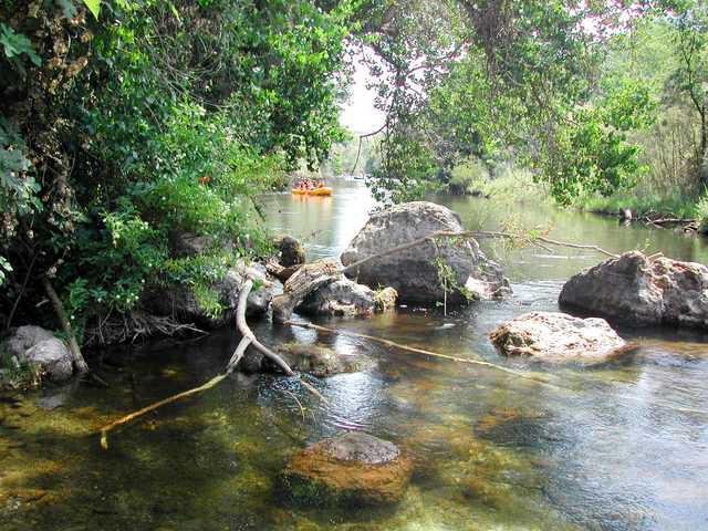
The general plan calls for exploring with the San Joaquin County, state Department of Parks and Recreation and Army Corps of Engineers ways to create synergy between Dos Reis, Mossdale County Parks, Caswell State Park and Army Corps of Engineer McHenry Recreation Areas with Manteca serving as the initial visitor center for the regional Stanislaus River park system.
The general plan wording also suggests exploring with the state Department of Parks and Recreation innovative ways to link visitor destinations in Manteca and Caswell State Park so that annual visitors increase to both and people are aware of the amenities at both.
It also calls for supporting public outreach campaigns that link the regional Stanislaus River park system as a natural stay over for visitors to Yosemite National Park.
The update notes open space is not limited to lands specifically designated open space. It also includes lands designated for recreational opportunities, including parks and public/quasi-public sites, and scenic and natural resource lands, including lands designated as water, creeks, and agriculture.
Manteca once looked at
River access to San Joaquin
Manteca leaders years ago toyed with the idea of creating some type of public access to the San Joaquin River.
It was envisioned in the southwest portion of the city near where Woodward Avenue at its western most point turns south and then jogs west again as Williamson Road.
The area was near the Thousand Trails Turtle Beach RV and camping facility where a slough provides access to the San Joaquin River.
The idea was to emulate, in some manner, Lodi Lake and its adjoining park off the Mokelumne River in northern San Joaquin County.
The idea never got off the ground.
And while such an undertaking would be complicated, cost money, and be a long-range project it is still looms as a possible objective for the city based on wording in the proposed general plan update.
The policy portion regarding open space calls for creating new wildlife habitat areas in appropriate locations, which serve multiple purposes.
Park system on the
lower Stanislaus River
The lower Stanislaus River has an extensive park system that is well maintained by the Army Corps of Engineers and open to public use.
Knights Ferry Recreation Area, the put in for rafting trips, is a sprawling park that includes multiple picnic table and BBQ sites, river access, extensive hiking trails, and access to the oldest covered bridge west of the Mississippi River.
Knights Ferry Recreation Area also is home to the Army Corps of Engineers local museum that includes local history displays as well as that of local flora and fauna.
Next in the park system is Horseshoe Park, another large park about 4 miles downstream of Knights Ferry. Access to this park is off of Orange Blossom Road. The park includes riverside picnic tables, options for overnight camping, and river boating access.
Orange Blossom Park is a large grassy park that is free for the public to use and located just 5 minutes east of Oakdale. The park is a common recreational boat use area, and is the location where many commercial rafting trips end. The park includes large group sites for picnicking and BBQing that can be reserved in advance.
Between Orange Blossom and Oakdale Recreation Area is a small river-access only campground called Valley Oak. This secluded site harbors multiple group sites and is perfect for groups looking for a more secluded camping experience right along the river. Restroom and BBQ access points are located within the park.
The next park in the Stanislaus River Park System is Oakdale Recreation Area.
It stretches along nearly a mile of the Stanislaus River, and is unique in that it also houses a number of small stocked ponds.
Because of this, most of the frequenters of the park are fishermen, as picnicking areas are few and far between. Another place for river access, Oakdale Recreation area is a great place to end or begin a recreational trip on the Stanislaus River.
The town of Riverbank surrounds Jacob Meyers Park, another large grassy piece of property along the north bank of the river. Revamped in the last decade, the park houses a boat ramp and a large playground for kids. Picnic tables, BBQ pits, and drinking water fountains are all available to the public. The rustic zone of the park covers over 40 acres and includes a mile-long walking/biking loop as well as a group campground.
At the end of the Stanislaus River Park system is McHenry Recreation Area south of Escalon on the north side of the river off of River Road.
The recreation area contains multiple trails along the river, as well as some secluded camping sites that can be reserved. Picnic areas are dispersed throughout the park as well. In the busy summer months this park gets impacted as well, so early arrival times are recommended.
To contact Dennis Wyatt, email dwyatt@mantecabulletin.com


