Just over 75 percent of impacted property owners cast votes to impose an assessment to leverage $473 million in enhanced flood protection for southwest Manteca, Lathrop, and the Weston Ranch area of Stockton.
The unofficial count of weight ballots — every dollar in assessed value equating one vote — was completed Friday after the mail-in ballot election ended during a San Joaquin Area Flood Control Agency (SJAFCA) hearing conducted Thursday at Lathrop City Hall.
The SJAFCA board needs to certify the results when they meet July 18.
Once they do, the residential tax assessment ranging from $10.52 to $83.44 a year depending upon exposure, will appear on property tax bills this fall.
The assessment ends after 31 years.
It will raise $110 million to leverage $363 million in state and federal funding to improve 15 miles of levees along the San Joaquin River, extend and enhance a dry levee south of Manteca, and fund affiliated levee improvements.
“I am very pleased with the results of the Mossdale Tract assessment local match as this helps SJAFCA continue to bring the federal and state share of this project to provide 200-year flood protection for our community,” noted Manteca Mayor Gary Singh.
Singh, along with Councilman Mike Morowit, serves as the city representatives on the SJAFCA board.
SJAFCA will move forward with the dry levee project first while working with federal and state agencies to obtain environmental clearance for levee work along the San Joaquin River.
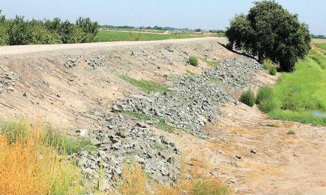
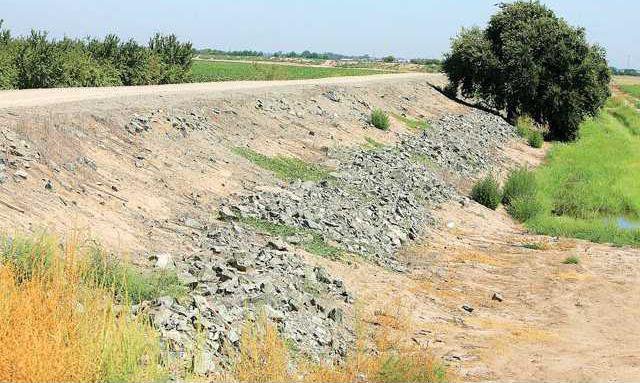
The work south of Manteca will extend an existing dry levee as well as widening it and increasing the height.
Construction on the dry levee is targeted to start in 2026.
The state has already set aside funds to allow the project to go forward while assessments are being collected to bond the overall project.
It is because the dry levee is considered an urgent project.
The reclamation district to the south of Mossdale Tract has had repeated levee failures along the San Josquin and Stanislaus rivers.
There have been 11 since 1929.
Several times — included in 1997 — floodwaters reached the existing dry levee that runs south of Airport Way and currently ends west of Airport Way.
The new dry levee will be extended almost all the way to Union Road.
In 1997, state emergency officials said the dry levee that had been covered with plastic sheeting came extremely close to falling.
The McKinley Avenue underpass on the 120 Bypass was plugged with an 8-foot high berm of dirt covered with plastic to protect city development north of the freeway.
Since then, development has occurred in southwest Manteca putting more than 2,000 current homes in danger of flooding.
The vote will have major long-term impacts on health and safety as well as the financial well-being of those residing in the 200-year floodplain.
*It will protect more than 20,000 existing homes and 55,000 residents as well as schools, highways railroad lines, businesses, San Joaquin Hospital, Manteca’s wastewater treatment plant, and other infrastructure.
*It means the state will not impose a moratorium on new construction including expansion of the footprint of existing structures starting in 2025.
*It will avoid any federal mandates for mandatory flood insurance that have annually costs starting at $1,700 as opposed to the highest residential assessment of $183 for additional flood protection.
Increased flooding risk
prompted need for levee work
The state mandate for 200-year flood protection after it was determined by the Federal Emergency Agency that the area around the San Joaquin-Sacramento Delta had the highest risk in the United States for a repeat of the 2005 Hurricane Katrina disaster in New Orleans.
The area covered by the levee work was expanded to include parts of Manteca east of Airport Way after a new California Department of Water Resources modeled showed there likely will be at least a tripling of flows in the San Joaquin River due to changing weather patterns.
The three times plus increase in river flows by 2070 would mean an additional five feet of water flowing by levees at the French Camp Slough.
Various models show precipitation patterns are slowly changing over Northern and Central California as they have done in a repeated cyclical pattern over the course of thousands of years.
As a result, flooding frequency is expected to rise.
Models point to less snow in the Sierra and more rain in the foothills and on the valley floor.
That means precipitation shifts could reduce the effectiveness of the flood control functions of major reservoirs. It may be due to more frequent warm rain melting snowpack throughout the winter, more perception falling below the basins feeding into reservoirs, or a combination of both.
As such, that increases the odds for flooding in Manteca — as well as Lathrop — given both cities are along the “last miles” where the 15,600 square miles of the San Joaquin River basin drains into the Delta.
Manteca — along with Lathrop, Stockton, and San Joaquin County — have been working to address the issue long before climate change entered the everyday vernacular.
It started with the California Legislature requiring more robust levees to protect against 200-year flood zones after levee failed in New Orleans during Hurricane Katrina.
Local concerns, though, preceding that as the paving over of land with impervious surfaces — streets, parking lots, rooftops, sidewalks and such upstream — had been increasing runoffs and the frequency of flooding measured by 100 year events.
In flood lingo, a 200-year event doesn’t mean a flood that will happen every 200 years.
Instead, it reflects the odds of such an event happening in any given year. That means there is a 1 in 200 chance of an event occurring in any given year requiring the levee work now being pursued.
Roughly 40 areas in California including Manteca-Lathrop-Stockton fall within peer reviewed science that designated 200-year flood plains. They must have — or be in the physical process of constructing — protection to guard against such an event by 2030.
To contact Dennis Wyatt, email dwyatt@mantecabulletin.com


