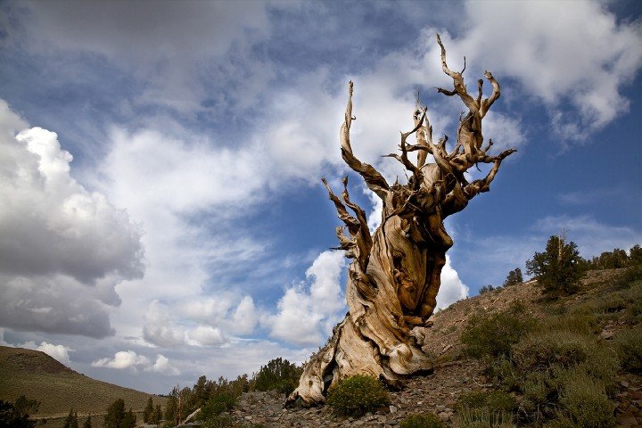
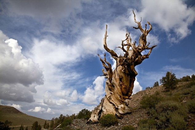
The first time I came across a bristlecone pine I was near the roof of Death Valley — Telescope Peak’s summit at 11,049 feet — I thought the tree was dead.
It was a gnarly mess that looked like a gigantic piece of twisted driftwood tortuously contorted without a single visible sign that it was alive.
Subsequent research — and a side trip several years later to the Schulman Grove and Patriarch Grove during a hiking trip to White Mountain at 14,252 feet — I came to realize I had the privilege of seeing some of the oldest trees in the world up close.
Somewhere amid those twisted trees in the White Mountains that have more exposed roots than a shallow planted mulberry tree could ever produce, stands the tree researchers have determined is the oldest tree on earth that’s been dubbed Methuselah. It is 4,855 years old.
It is deep in the White Mountains of the Inyo National Forest somewhere around the 11,000-foot level just like the bristlecone pines some 40 or so miles away on Telescope Peak.
To give you an idea of the age, Methuselah was 2,800 plus years old during the Roman Empire years of 27 BC to 476 AD.
It is one of many remarkable extremes nature has created within the geographical boundaries that were carved out to make California a state 175 years ago.
The Golden State is blessed with the tallest tree on earth, the biggest tree in terms of mass on the planet that is also considered the largest living thing based on mass, the lowest point in North America, and the highest point in the 48 lower states.
And they are all reachable within a day’s drive or less from the Northern San Joaquin Valley.
The ancient bristlecone forest that includes a visitors’ center at Schulman’s Grove is 23.8 miles northeast out of Big Pine (on Highway 395 south of Bishop) via Highway 168 to White Mountain Road.
The drive takes 48 minutes as the highway at one point goes down to one lane through a narrow gorge and the road you turn on — while paved — is twisty with incredible views. There are Inyo National Forest camp sites on the way to the visitors’ center that is only open in the summer.
The trails at the Schulman’s Grove are fairly easy.
The Patriarch Grove is 12 miles north of there via dirt road that eventually leads you to the “trailhead” for the slog up White Mountain.
It is much easier to ascend and descend than Mt. Whitney across Inyo Valley in the eastern Sierra that is the tallest peak in the 48 states at 14,508 feet and some 256 feet higher.
There is an actual dirt road that serves as the trail. The only vehicles allowed are forest services and those involved with university research. It is a slog but there are no drop-offs like on Mt. Whitney and there are a lot less people as in almost no one.
And unlike Mt. Whitney you don’t have to pay to hike it or get into a lottery to do so.
That said, when I hiked it we were passed by someone who rode their mountain bike to the summit and back down.
It is safe to say it is the only 14,000-footplus peak in California that you can access with a mountain bike or — if you worked the right job — could drive to the top.
Iit is completely exposed all the way to the elements — sun, snow, and wind.
If you want to do a two-for in terms of 14,000 foot peaks you can summit without special climbing and mountaineering skills in one trip, Mt. Whitney and White Mountain are the perfect combo.
It is predicated, of course, on when you can secure a Mt. Whitney permit. Due to road closures, White Mountain can be hard to access at times of the year. There have been more than a few who have done the hike in winter as the snow isn’t overwhelming but the wind and open exposure can be rough.
I’ve also talked to people who have been caught in relatively rare lightning storms on the exposed mountain who have said it redefines the concept of heart stopping.
That said, the White Mountains are in the rain shadow of the much higher Sierra.
You can stay in Big Pine and easily drive to the trailheads of both mountains.
You are also near the lowest point in North America — Death Valley’s Badwater Basin at 278.9 feet below sea level. Death Valley along with Mt. Whitney and White Mountain are all located in Inyo County.
Most people walk out to the salt pans just off the visitors’ area off the Badwater Road.
It is an impressive site to look up to the east right behind you and see the extremely sharp upward thrust of the Funeral Mountain that looks as if it goes almost straight up for a mile.
You can drive to the ridge overlooking Badwater — Dante’s View at 5,475 feet. But to get a good idea of how amazing the geology is you can see a large marking on the nearly straight up and down portion of the Funerals directly across from the Badwater parking lot that reads “Sea Level” some 278 feet above.
The actual lowest point is well over a mile to the west. There is a geological marker that even with GPS is a basically akin to looking for a needle in the haystack to find.
My efforts to do so were futile.
What I would like to do some day sounds a bit crazy is to hike from Badwater cross-country to Telescope Peak some 22 miles away. The 11,324 net elevation gain is the sharpest rise in all of the Americas based on distance and height.
I’ve been told the right route has minimal scrambling.
That said, even in late fall, early winter, or late winter when snow at the higher elevations is minimal and it’s not too hot on the valley floor several that have done it say it requires stashing water in advance at several locations that require pre-hikes to do so.
You also obviously would want to have a car waiting for you at Mahogany Flat Campground, the closest point you can park a vehicle in the Panamint Range. After peaking Telescope, it is a seven mile hike down to the campground at the 8,000 foot level. You definitely don’t want to forget to bring the car keys.
The tallest tree on earth — Hyperion at 380.1 feet — was discovered in 2006 in a remote part of the Redwood National Forest along Highway 1 heading to Eureka. Its exact location also is kept secret from the general public to protect it.
You can take in redwoods nearly as tall throughout the Bay Area with Big Basin Redwood State Park in the mountains to the northwest of San Jose being the most accessible and arguably the most impressive.
The biggest tree on earth by volume is believed to be the General Sherman tree found in Sequoia National Park east of Visalia. You can walk almost right up to the middle-aged sequoia — it’s about 2,000 years old. It is 274.9 feet high with a whopping 52,500 cubic feet in volume. The oldest sequoia is around 3,200 years in age.
The closest sequoias — they are kissing cousins to the redwood — are Calaveras Big Trees and three groves in Yosemite National Park.
To contact Dennis Wyatt, email dwyatt@mantecabulletin.com
,


